GIS (Geographic Information System) is a concept that allows for the collection, management, analysis, and integration of various types of data. Through GIS, territories can be analyzed, and information layers can be organized into visualizations using maps. With this feature, GIS generates a clearer understanding of data, such as relationships, models, and contexts, helping users of this system make optimal decisions.
Development/translation of land use or urban planning documentation into GIS format
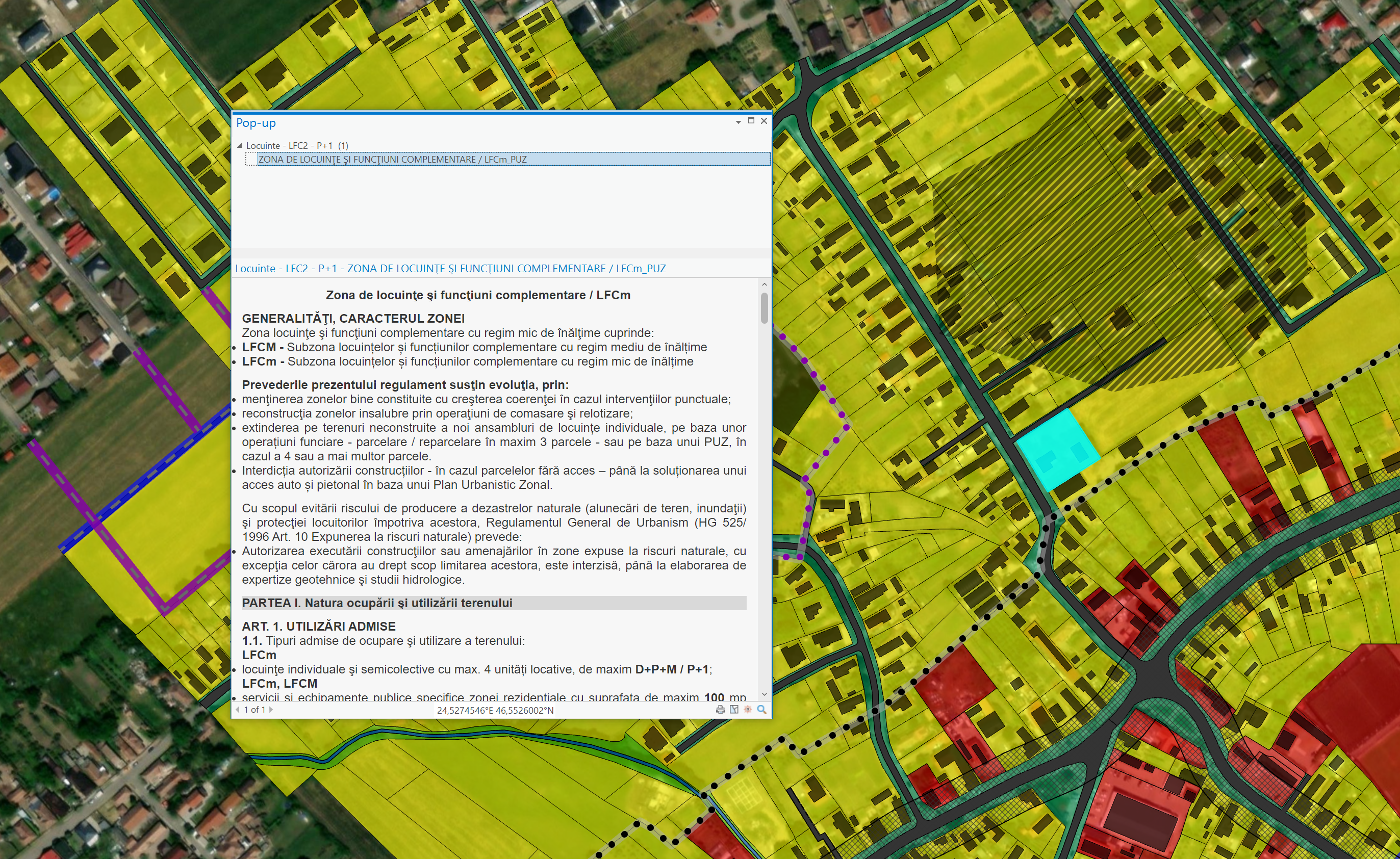
Developing or translating land use or urban planning documentation into GIS format involves using technology to create geospatial maps and models that present information from the territory within this documentation.
Spatial data set acquisition services from the field and their integration into an operational GIS solution
The operational GIS solution provides the possibility of obtaining and using precise and updated geospatial data for a variety of purposes.
We use state-of-the-art technologies to collect, store, process, and analyze geospatial data. We offer mapping services, geospatial data analysis, GIS application development, GIS system implementation, and technical consulting, and guarantee that geospatial data is precise, complete, and updated.
Through these services, valuable information can be obtained for various industries, such as construction, energy, transportation, or agriculture, and new business opportunities or areas with development potential can be identified.
This information can be kept up to date by us or by GIS system beneficiaries.
We currently provide GIS services for several
UATs in Transylvania.
Other services
Elaboration / updating of land-use planning documents
Urban planning documentation development / update
Elaboration / updating of land-use planning documents